The Daxue Mountain Range
The Daxue Mountain Range
A 400 km massif in western Sichuan, Daxueshan peaks at Mount Gongga (7,556 m) and marks the frontier between Han Chine and the Tibetan world.
The Daxue mountain range, or Daxueshan in Chinese (meaning "Great Snow Mountains"), stretches for nearly 400 km across the western Sichuan province, in the southwest of Chine. Oriented north-south, it forms part of the Hengduan mountain system, which borders the eastern Tibetan plateau. It also marks a cultural frontier between traditional Chine and the Tibetan world, around cities such as Kangding.
Why visit the Daxue mountain range?
Daxueshan is one of the great eastern Himalayan massifs. Mount Gongga, its highest peak, reaches 7,556 m and stands as Sichuan's tallest summit. Several other peaks exceed 6,100 m, with the snowline situated between 4,600 and 5,500 m. The massif is primarily composed of granite and sandy slate, and separates two major tributaries of the Yangtze: the Yalong to the west and the Dadu to the east.
Beyond its sheer dimensions, Daxueshan draws its appeal from its position as a transition zone: it demarcates the Tibetan plateau to the west and the Sichuan basin to the east, and connects south to the Daxiangling and Xiaoxiangling ranges near Xichang. This geographic crossroads grants the massif layered biodiversity and varied human settlement, from Han agricultural villages to Tibetan communities in the high valleys.
What to see and do in the Daxue massif?
Peaks and glaciers
Mount Gongga remains the massif's flagship attraction, with its glacial complex visible from several accessible viewpoints around Moxi and Konka monastery. For experienced climbers, several summits above 6,000 m offer technical routes. For travellers without extreme altitude experience, viewpoints and acclimatization walks around 3,500 to 4,500 m allow you to observe the main ridges without technical commitment.
Forests, meadows and wildlife
The wetter eastern slope is covered in birch, hemlock, poplar and aspen forests. As altitude increases, fir and spruce forests emerge, followed by alpine meadows beyond 3,000 m. The upper forest boundary sits around 4,000 m. This layered ecosystem shelters characteristic Himalayan fauna, including protected species within reserves attached to Gongga.
Villages and mountain agriculture
In the lower valleys, mountain farming remains alive: wheat, corn, hardy oats and potatoes make up the bulk of crops. Tibetan and Qiang villages offer a glimpse into a high-altitude way of life, with stone houses and scattered monasteries. Several road routes allow you to connect these valleys over a few days.
When to go?
Daxueshan's climate blends subtropical and temperate plateau influences. Annual rainfall ranges between 800 and 900 mm, with a marked peak from June to September: this is the monsoon season, often cloudy and unfavourable for climbing. Humidity is higher to the east than the west. In winter, temperatures can drop to −20 °C above 5,000 m.
The two recommended seasons for alpinism and high-altitude trekking are:
- April-May: stable weather before the monsoon, snow still present at altitude.
- Late September to November: often clear skies, cool but manageable temperatures.
For mid-altitude hiking and village exploration, the shoulder seasons remain most comfortable.
How to get there?
Four towns serve as logistical bases for entering the massif: Kangding, Moxi, Danba and Shimian. Kangding, reachable by bus from Chengdu in one day, remains the primary access point to the western slope and the Gongga area. Moxi is the classic base for the Hailuogou glacier on the eastern slope. Plan for at least one day's travel from Chengdu to reach the zone, and 2 to 3 additional days to reach the western face depending on your itinerary.
Practical information
- Altitude: plan for acclimatization in Kangding (approximately 2,560 m) before any higher climb.
- Gear: warm clothing year-round at altitude, technical equipment for any climb above 5,000 m.
- Permits: some climbing zones require authorization, to be arranged in advance with a local English-speaking agency.
- Level: the massif suits travellers in good physical condition for approach routes, and experienced climbers for the summits.
Nearby attractions
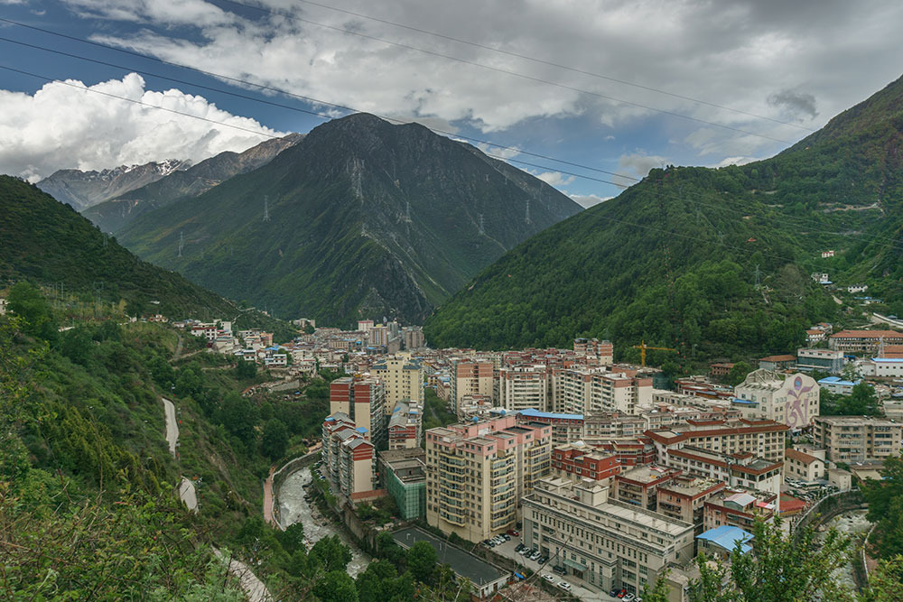
The city of Kangding serves as both the logistical departure point and a cultural site in its own right, at the crossroads of Han and Tibetan worlds. To extend your Chine trip, you can combine Daxueshan with less obvious sites: the Beishan temple for its Buddhist architecture, or the Baigongfang Crafts Museum for cultural insight.
Frequently asked questions
Frequently asked questions
Mount Gongga, at 7,556 m, is the massif's highest summit and the tallest peak in all Sichuan province.
No. The summits require technical experience, but the valleys, Tibetan villages, accessible glaciers (such as Hailuogou) and mid-altitude viewpoints can be explored without mountaineering gear.
Kangding for the western slope and general access, Moxi for the Hailuogou glacier, Danba for the northern Tibetan valleys, Shimian for the southern massif.
Plan for a minimum of 4 to 5 days from Chengdu with acclimatization, and 8 to 12 days for a meaningful trek or high-altitude climb.
Yes, from Kangding onwards (2,560 m) and especially above 4,000 m. A gradual ascent over several days is essential.
Looking to include Daxueshan in a Sichuan itinerary? Browse our Chine travel ideas to build a tailor-made stay between Chengdu, Kangding and the high Tibetan plateaus.
Interested in this visit?
We can include it in your personalised itinerary.