Inner Mongolia, another world north of China
Renowned for its vast grasslands and history linked to nomadic peoples, Inner Mongolia is a region apart in China.
Renowned for its vast grasslands and history linked to nomadic peoples, Inner Mongolia is a region apart in China. Nevertheless, it has not escaped Han colonisation, today the overwhelmingly dominant ethnic group over the Mongols themselves.
Inner Mongolia 内蒙古 Nèiměnggǔ (Abbreviation: 蒙 méng)
In Mongolian language: Öbür mongɣul Status:
Autonomous Region of Inner Mongolia (内蒙古自治区 Nèiměnggǔ Zìzhìqū)
Regional capital: Hohhot (or 呼和浩特 Hūhéhàotè in Chinese)
Total area: 1,183,000 km²
Population: 23,840,000 inhabitants
Did you know?
The Mongol ethnic group represents only 17% of the province's population, inhabited by 79% Hans. The latter are generally concentrated in urban centres, where they sometimes represent more than 90% of the population.
A military and space base is located in the western part of Inner Mongolia, at Jiuquan. It was from this base that China's manned spaceflights were launched.
Many Mongols, traditionally nomadic, became sedentary during the collectivisation period of the 1950s and 1960s.
Xi Shun, the world's tallest living man according to the Guinness Book of Records, is from Inner Mongolia.
Overview
Inner Mongolia is one of five autonomous regions of the People's Republic of China, and ranks as the 3rd largest Chinese territorial subdivision by area after Xinjiang and Tibet.
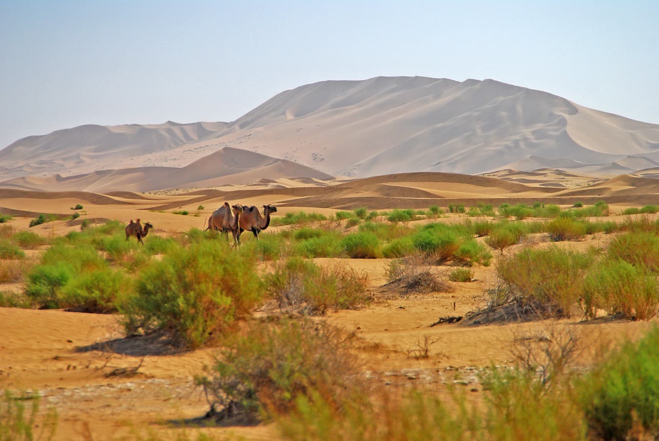
A region renowned for its vast grasslands, Inner Mongolia is nonetheless largely desert, notably hosting the Gobi Desert within its borders.
The region's name is intended to distinguish it from the independent state of Mongolia and the Republic of Tuva in Russia, which from the Chinese perspective constitute Outer Mongolia. The Chinese autonomous region is therefore the southern part of the regional entity known as Mongolia (or Greater Mongolia).
The Mongols themselves do not use the terms inner and outer to refer to their territories, as these concepts feel too Sino-centric to them. The terms used are South Mongolia (in China) and North Mongolia (the independent state).
The Chinese autonomous region of Inner Mongolia borders the provinces of Heilongjiang, Jilin and Liaoning to the east, Hebei, Shanxi and Shaanxi to the south, and the Ningxia Hui Autonomous Region and Gansu Province to the west.
To the north, it shares 4,221 km of borders with Mongolia and Russia.
The main cities of the province:
Name | Chinese Characters | Population |
Baotou | 包头 | 1,301,768 |
Hohhot (Huhehaote) | 呼和浩特 | 763,645 |
Chifeng (Ulanhad) | 赤峰 | 356,805 |
Tongliao | 通辽 | 264,119 |
Jining | 集宁 | 263,209 |
Wuhai (Haibowan) | 乌海 | 226,732 |
Hailar (Hulunbuir) | 海拉尔 | 215,869 |
Linhe | 临河 | 170,937 |
Ulanhot (Wulanhaote) | 乌兰浩特 | 167,145 |
Jiagedaqi |
| 136,811 |
Zalantun (Butha Qi) | 扎兰屯 | 132,408 |
Xilin Hot (Xilinhaote) | 锡林浩特 | 123,198 |
Yakeshi (Xuaguit Qi) | 牙克石 | 116,044 |
Zhalainuoer (Jalai Nur) |
| 108,663 |
Dongsheng | 东胜 | 101,698 |
Administrative divisions
Inner Mongolia is divided into twelve prefectures comprising nine urban communities and three leagues.
The nine urban communities are:
Hohhot (呼和浩特市 Hūhéhàotè shì)
Baotou (包头市 Bāotóu shì)
Wuhai (乌海市 Wūhǎi shì)
Chifeng (赤峰市 Chìfēng shì)
Tongliao (通辽市 Tōngliáo shì)
Ordos (鄂尔多斯市 È'ěrduōsī shì)
Hulunbuir (呼伦贝尔市 Hūlúnbèi'ěr shì)
Bayannur (巴彦淖尔市 Bāyànnào'ěr shì)
Ulanqab (乌兰察布市 Wūlánchábù shì)
The three leagues are:
Xilin Gol (锡林郭勒盟 Xīlínguōlè méng)
Alxa (阿拉善盟 Ālāshàn méng)
Xing'an (兴安盟 Xīng'ān méng)
These twelve prefectures are themselves organised into one hundred and one district-level subdivisions, comprising twenty-one districts, eleven municipal districts, seventeen counties, forty-nine banners and three autonomous banners.
Geography
Primarily consisting of high plateaus—most of the territory lies above 1,000 metres above sea level—Inner Mongolia is centred around the Yinshan mountain range, its highest point reaching 3,556 metres (the Helan Shan chain).
The north of the region is occupied by the Gobi Desert, the east is covered by the virgin forests of the Great Hinggan, while the west consists mainly of the Ordos desert plateau.
The region contains 880,000 km² of grasslands, representing 21.7% of China's national total.
The climate is continental with long winters, January temperatures averaging between -20°C and -6°C. This can drop to -30°C in the far north-east. In July, temperatures rise to 20-25°C.
History
To be truly complete, the history of this region must be considered on the scale of Greater Mongolia. Nevertheless, a brief history of the region now called Inner Mongolia is possible.
Throughout its history, it has been controlled by different peoples: in the south, it was generally Chinese farmers, while in the north, various nomadic tribes successively held sway, such as the Xiongnu (Huns), Xianbei, Khitan, Jurchen (Manchus) and Mongols.
During the Warring States period (-453 to -221), King Wuling (-340 to -295) of the state of Zhao (Hebei and Shanxi) pursued a policy of expansion into Inner Mongolia and had a wall built in the Hetao region.
Qin Shihuangdi, upon achieving the first Chinese unification, sent one of his generals to fight the Xiongnu and incorporated the wall of the state of Zhao into his Great Wall. He also adopted a policy of solidifying Chinese presence in the region, but his efforts would dissipate with the fall of the Qin dynasty in -206.
Successive political powers then had to contend with the Xiongnu and later other nomadic peoples such as the Khitan and Jurchen... When Genghis Khan subsequently unified the various Mongol tribes and subjugated nomadic peoples, his descendants unified China in 1279 under the Yuan dynasty.
In the 17th century, it was the Manchus who took control of the area, before establishing their Qing dynasty, thus ruling all of China. Under this rule, Mongolia was organised into leagues and banners, with Mongols forbidden to travel outside their leagues... The eastern part of the province was part of Manchuria.
The first Chinese farmers in the region appeared in the 16th century, in the time of Altan Khan, future founder of the city of Hohhot and creator of the title of Dalai Lama so dear to Tibetans.
Massive immigration of Chinese, primarily Han, began later, in the late 19th century: in 1878, the first colonisation offices and Chinese districts were opened in southern Mongolia (via lands sold or rented by Mongol lords, or territories requisitioned from the nomads present).
In the Republican era, Mongolia declared its independence in 1912, thanks to Russian support. The current Inner Mongolia was divided into several parts: Rehe, Chahar, Suiyuan and Ningxia.
In 1931, the eastern part of present-day Inner Mongolia, then attached to Manchuria, fell under Japanese control and became part of the puppet state of Manzhouguo along with Rehe, from 1 March 1932.
With the beginning of the Sino-Japanese War, the status of the region became highly unstable. The State of Mengjiang (蒙疆, literally 'Mongol territories'), still under Japanese control, was established first. The entity's name evolved in 1936 to become the Mengjiang Joint Committee (mengjiang lianhe weiyuanhui 蒙疆联合委员会), then the Mengjiang United Autonomous Government (mengjiang lianhe zizhi zhengfu 蒙疆联合自治政府) in 1939.
In the meantime, on 8 December 1937, Mongol sovereign Dewang (Demchugdongrub) declared the independence of Inner Mongolia as Mengjiang or Mengguguo and signed agreements with Manzhouguo and Japan. The capital was established at Zhangbei, near Kalgan (currently Zhangjiakou).
On 4 August 1941, it was renamed the Autonomous Federation of Mongolia (menggu zizhi bang 蒙古自治邦). These manipulations, initiated by the Japanese to weaken China, bore no fruit as the created territory's borders encompassed a population that was 80% Han...
The State of Mengjiang ceased to exist after 1945 and Japan's surrender. Chinese Communists then took control of Inner Mongolia and Manchuria, and established the Autonomous Region of Inner Mongolia on 1 May 1947.
From 1954 onwards, Inner Mongolia absorbed former territories: part of the provinces of Suiyuan and Ningxia in 1954, and part of Rehe province in 1955. The current boundaries of the region were then defined, though its status was merely that of a Chinese province.
With the Cultural Revolution, Inner Mongolia had to cede approximately half of its territory to its neighbours (Ningxia, Gansu, Liaoning, Jilin, Heilongjiang). All territories were nonetheless returned in 1979.
An Inner Mongolia People's Party (Neirendang) existed before 1949. It was simply merged, or rather absorbed, by the Chinese Communist Party when it came to power.
This did not prevent severe repression during the Cultural Revolution from 1966 to 1976, under the pretext that the Mongol party had been secretly reformed and threatened national security. Approximately 800,000 people were repressed, of whom 30,000 were beaten to death and 120,000 mutilated.
Culture
While the two official languages of Inner Mongolia are Mandarin Chinese and Mongolian, local populations speak numerous dialects, derived from Mandarin and Jin for the Han Chinese...
Much depends on the surrounding linguistic groups and the region's history. Thus, in the east, inhabitants speak a dialect close to north-eastern Mandarin, which is explained by the area's attachment to Manchuria for many years.
Urban Mongol populations, especially new generations, tend to speak Mandarin fluently nonetheless, even if the maintenance of tradition is not as strong as in rural areas.
In cities, the law requires dual Chinese/Mongolian inscription, resulting in an atypical situation: while the independent Mongol state adopted the Cyrillic alphabet, China's Mongols have retained the traditional alphabet.
Among the traditional arts and disciplines of the region, one finds acrobatic circus arts and Mongolian wrestling, often taught to children.
As for gastronomy, Mongolian hot pot is highly renowned. If you visit, you can also be served whole roasted sheep with the abdomen filled with onion, ginger, pepper and green salt...
Economy
Inner Mongolia is a region rich in mineral resources and coal mines. Near Baotou, at Baiyun Obo, lies the world's largest 'rare earth' mine (a group of metals).
Industry thus develops around coal, electricity, cashmere, chemicals and related industries. Forestry and hunting are important in the east, in the Da Xing'an region, while grain cultivation prevails in valleys near rivers.
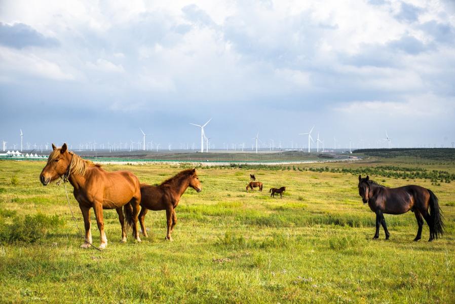
In drier areas, livestock raising (sheep, goats, cattle, horses) ensures the inhabitants' survival.
Two major dairy companies, Yili and Mengniu, are based in Inner Mongolia.
Tourism
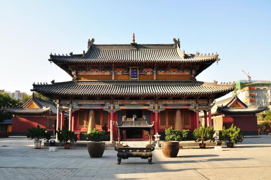
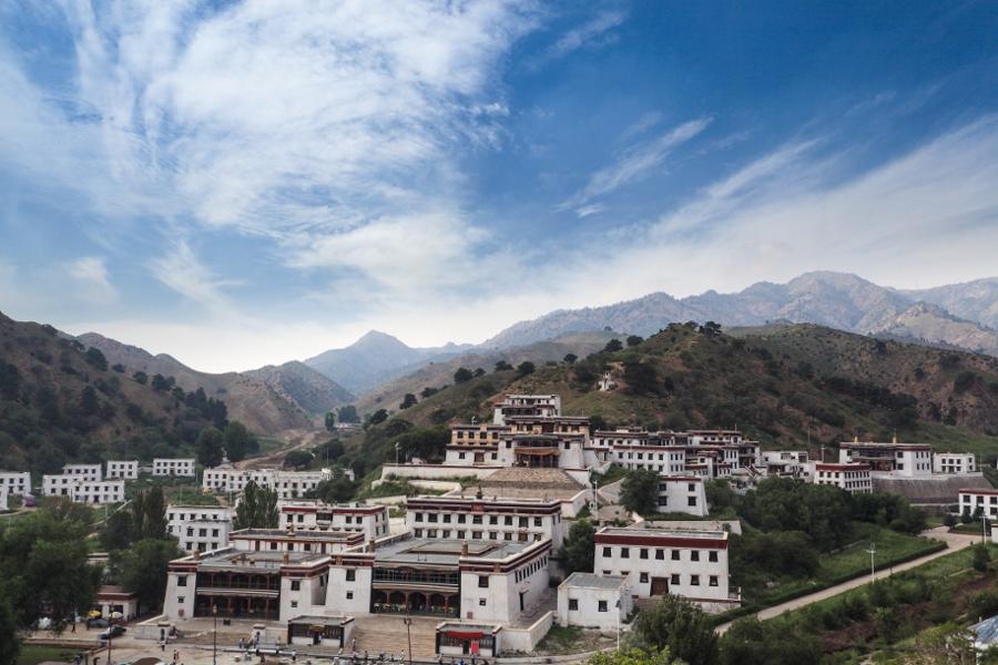
As for tourism, Inner Mongolia tends to be presented as an attractive new destination. In the regional capital, Hohhot, the main attraction is the Tibetan Buddhist heritage.
There are indeed three important Lamaist temples: Dazhao, built in 1580 and famous for its silver Buddha and dragon sculptures; Xiaozhao, built in 1697 and highly appreciated by Emperor Kangxi of the Qing dynasty; and Xilituzhao, the largest Lamaist temple in the area and formerly a local centre of the religious movement.
One also finds the tomb of Wang Zhaojun, a woman offered in marriage to Xiongnu Emperor Huhanye, who is said to have brought sixty years of peace between Han dynasty China and the Xiongnu.
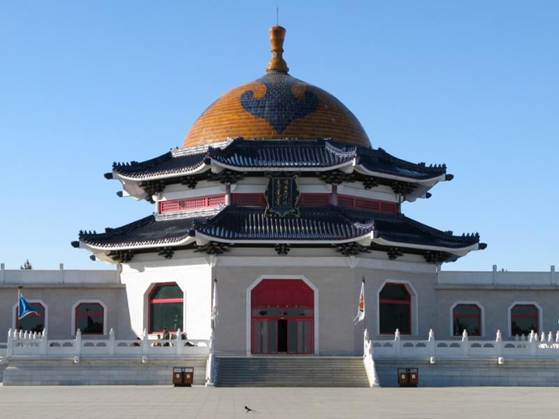
In Ordos prefecture, the main attraction is the Mausoleum of Genghis Khan. Near Beijing, the Bashang grasslands are renowned for the calm they can bring to city dwellers overwhelmed by stress.
Frequently asked questions
To reach Inner Mongolia from France, you generally need to take an international flight to Beijing or another major Chinese city, then a domestic flight or train to Hohhot, the regional capital. High-speed rail connections link Beijing to Hohhot in approximately 2.5 hours. A Chinese visa is mandatory for French nationals.
The best time to visit Inner Mongolia is summer, from June to August, when the grasslands are verdant and temperatures are pleasant (20-25°C). This is also the period of the Naadam festival, a celebration of traditional Mongolian sports. Winters are extremely harsh, with temperatures dropping to -30°C in the north-east.
Yes, it is entirely possible to stay in a traditional yurt (ger) in Inner Mongolia, particularly in the grassland areas around Hohhot or in the Hulunbuir region. Many tourist camps offer this experience, often combined with horseback riding and traditional Mongolian meals.
Inner Mongolia is an autonomous region of China, constituting the southern part of Greater Mongolia. Mongolia (or Outer Mongolia from the Chinese perspective) is an independent state located to the north. The Mongols themselves prefer the terms 'South Mongolia' for the Chinese region and 'North Mongolia' for the independent state.
Among the must-sees of Inner Mongolia are the Lamaist temples of Hohhot (Dazhao, Xiaozhao, Xilituzhao), the Mausoleum of Genghis Khan in Ordos prefecture, the Bashang grasslands near Beijing, Gobi Desert landscapes in the west and the virgin forests of the Great Hinggan in the east. The grasslands also offer yurt stays and horseback riding.
The two official languages of Inner Mongolia are Mandarin Chinese and Mongolian. In cities, dual Chinese/Mongolian inscription is mandatory. Unlike independent Mongolia, which adopted the Cyrillic alphabet, China's Mongols have retained the traditional Mongolian alphabet. The population being composed of 79% Han, Mandarin is the dominant language, especially in urban centres.